 |
| image: KCNA |
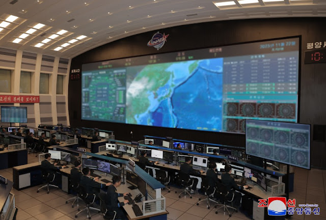
Colin Zwirko of North Korea News brought the image above to my attention. It accompanies a KCNA news bulletin about a visit of Kim Jong Un to the NADA Control Center in Pyongyang, on November 22, about half a day after launch of the Malligyong-1 satellite.
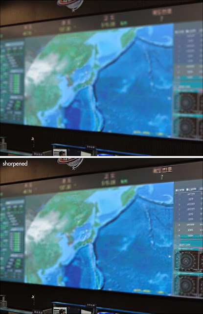
Colin pointed out that you can just make out what appears to be a satellite ground-track on the blurred map on display in the control center.
In the KCNA bulletin, it is claimed that KJU, during his visit to the center:
"watched the aerospace photos of Anderson Air Force Base, Apra Harbor and other major military bases of the U.S. forces taken in the sky above Guam in the Pacific, which were received at 9:21 a.m. on Nov. 22."
At 9:21 am local time in Pyongyang (00:21 UTC) on November 22, Malligyong-1 was indeed just appearing over the horizon at, and coming in radio reach of, NADA Control Center, having passed over Guam seven minutes earlier, near 9:18 local time in Pyongyang (00:18 UTC). At 9:25:27 local time (00:25:27 UTC), the satellite was closest in range to the NADA Control Center (I mention this as it becomes relevant later).
These three images below show the ground-track and position of Malligyong-1 and its footprint (the area that has the satellite above the local horizon) for the moment it passed over Guam (00:18 UTC); for the claimed moment North Korea received images (00:21 UTC); and for the moment of closest range to the NADA Control Center (00:25:27 UTC):
So theoretically, it is indeed possible that Malligyong-1 made images of Guam near 00:18 UTC, and relayed these to the NADA Control Center a few minutes later, starting around 00:21 UTC when it came into radio reach of the latter.
(note added 3-12-2023: this could perhaps indicate it only broadcasts a signal when in range of Pyongyang. This would explain why people like Scott Tilley and me have not been able to find it active in radio frequencies: it is imperative that radio operators in Japan and South Korea try if they can find it active. First try the lower reaches of UHF, i.e. 400-500 MHz, as that is where for example the Iranian Nour satellites broadcast and we know there are connections between the N-Korean and Iranian rocketry programs).
The line on the map on display in the NADA Control Center in the KCNA image conforms to the Malligyong-1 pass in question. A bright dot on the track over the Sea of Japan seems to closely conform to the point of closest range to NADA CC, around 00:25:27 UTC (see also the animated GIF further down in this blogpost):
 |
| click to enlarge |
Compare to this map I made of the Malligyong-1 ground-track around that time:
 |
| click map to enlarge |
In this animated GIF, I have superposed both maps, showing the match:
This however does not necessarily mean that North Korea indeed obtained imagery of Guam on this pass, as is claimed in the KCNA bulletin.
Usually, a satellite goes through a checkout-phase first before becoming fully operational. Solar panels and antenna's have to be unfurled, systems started up and checked, attitude and pointing brought under control, camera's calibrated. This check-out phase usually takes days to weeks. Having imagery within hours, would be quite fast.
So unless North Korea publishes the imagery, it remains conjecture whether the claim is true or just propaganda.
One final thing to remark: if the image in the NADA Control Center was indeed taken during KJU's visit around 10 am local Pyongyang time (according to KCNA) on November 22, this means it was taken before orbits of Malligyong-1 became publicly available. The first public available, US released orbit is of epoch 00:14 UTC on the 22nd, but was not released untill 3:26 UTC, some 2.5 hours after KJU's visit and, it appears, some two hours after the image in the NADA Control Center was taken..
 |
| click to enlarge |
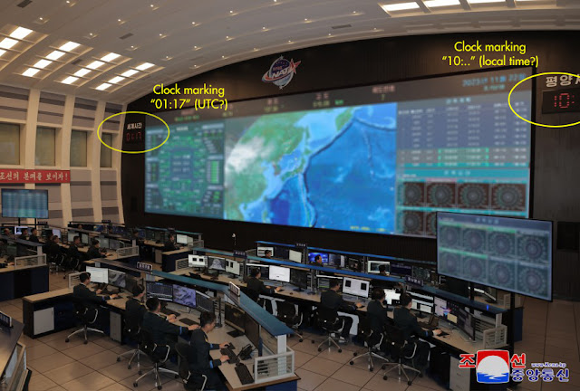
Two clocks are visible in the photograph that would indicate it was indeed taken during KJU's visit, around 1:17 UTC, and therefore before public release of orbital elements: one partial clock can be seen on the right, marking "10:.." in likely local time, the other on the left can be seen in full and is marking "01:17" in what is likely UTC (maybe someone fluent in Korean could confirm what the Korean text above the clock says?).
The image would then date to about 1 hour after any imagery of Guam was obtained.
The orbit on the map in the NADA Control Center conforms to the real orbit in detail, suggesting (if we take face value that the photograph was taken at 01:17 UTC) that North Korea did have either their own tracking data or a telemetry-derived orbit already before the US tracking network published the first public orbits. (while some might say this is perhaps not surprising, and I agree, I mention it because there are still those who question any indigenous capacity North Korea might have when it comes to their missile and space program)
It is of course possible that the image in reality was shot at a later moment, after the orbital elements were publicly released, and the clocks doctored (I mention this as North Korea has a history of doing this kind of stuff).
UPDATE 27 Nov 2023:
On November 25, a new KCNA bulletin mentions a second visit of Kim Jong Un to the NADA Control Center that day where he "watched the photos of major target areas in the enemy region, including Jinhae, Pusan, Ulsan, Phohang, Taegu and Kangrung, taken by
the reconnaissance satellite from 09:59:40 to 10:02:10 a.m.".
Specifically are mentioned, photographs:
"taken by the reconnaissance satellite at 10:01:10 shows the U.S. Navy
nuclear carrier Carl Vinson, which is anchored at the military port in
Ryongho-dong, Nam-gu of Pusan City"
...and photographs of the:
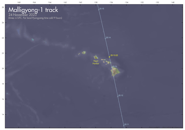
"naval base in the Pearl Harbor, the Hickam air-force base in Honolulu and other objects, taken by the reconnaissance satellite while passing over Hawaii of the U.S. at 05:13:22 a.m. on Nov. 25 in Pyongyang time"
Again, the quoted times match the closest approach points on actual passes over/near these targets, as can be seen in the maps below. And the USSN Carl Vinson is in Busan (Pusan) harbor, as Jeffrey Lewis pointed out on Twitter (this does not necessarily mean they have this info of satellite imagery of course).
(in the maps below, quoted times and dates are in UTC. To get Pyongyang local time, add 9 hours).
 |
| click map to enlarge |
 |
| click map to enlarge |


No comments:
Post a Comment