 |
| click map to enlarge |
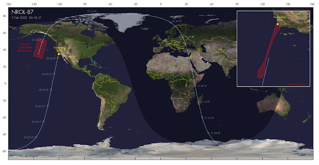
If weather cooperates, SpaceX will launch a classified payload for the National Reconnaissance Office (NRO) on 2 February 2022 at 20:18 UT [the launch eventually was at 21:27 UT]. This launch, from Vandenberg SLC-4 in California, is designated NROL-87.
Both (limited) specifications in a published contract for this launch (which states the intended orbital inclination and semi-major axis as respectively 97.4 degrees and 6890.7 km), as well as the position and orientation of hazard zones published in Navigational Warning NAVAREA XII 45/22 point to a launch into a 97.4 degree inclined, Sun-Synchronous Low Earth Orbit at about 512 km orbital altitude.
Analysts suspect the classified payload is one of a new generation of electro-optical IMINT satellites (either the first, or possibly the second, after USA 290/NROL-71, but in the latter case in a clearly different orbit) that is a follow-up to the KH-11 program. The sun-synchronous character of the intended orbit supports interpretation as an IMINT mission.
The image in top of this post gives the launch trajectory. The hazard areas I plotted in the map are from Navigational Warning NAVAREA XII 45/22 and they match a launch into an orbital plane with the quoted orbital inclination of 97.4 degrees:
280731Z JAN 22
NAVAREA XII 45/22(17,18,19).
EASTERN NORTH PACIFIC.
CALIFORNIA.
1. HAZARDOUS OPERATIONS:
A. 1907Z TO 2138Z DAILY 02 AND 03 FEB
IN AREA BOUND BY
34-42N 120-41W, 34-41N 120-32W,
34-31N 120-26W, 34-18N 120-30W,
33-40N 120-53W, 32-10N 121-24W,
31-25N 121-27W, 31-07N 121-40W,
31-09N 121-55W, 31-35N 121-52W,
32-17N 121-27W, 34-29N 120-46W.
B. 2110Z TO 2249Z DAILY 02 AND 03 FEB
IN AREAS BOUND BY
54-00N 144-30W, 50-45N 134-30W,
29-15N 140-00W, 32-30N 150-30W.
2. CANCEL THIS MSG 032349Z FEB 22.
The Falcon 9 upper stage from the launch makes a controlled reentry at
the end of the first revolution, in the Northeast Pacific roughly
between Alaska and Hawaii (the red box marked "B" in the map above).
If launch is indeed near 20:18 UT (the launch window of the Navigational Warning runs from 19:07 to 21:38 UT), then the orbital plane launched into results in passes near noon and midnight local time and (if the semi-major axis is correct) a ~5-6 day repeating ground track. A pre-launch estimated elset is here.
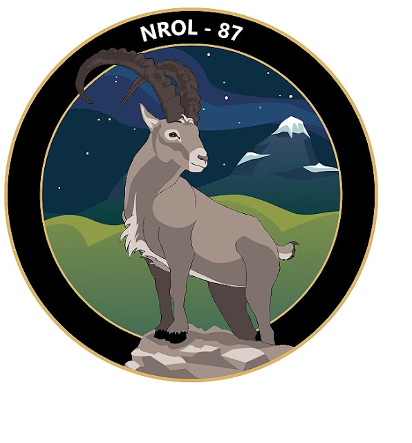
The Launch Patch for NROL-87 shows an Ibex keeping a watchfull eye over its territory:
No comments:
Post a Comment