In the context of the probable landing site of the recent Chinese Experimental Spacecraft (see previous post), I discovered a serious bug in my SkyTrack software.
As it turns out, when your chosen observing site has an altitude well over MSL, the sky positions in RA/DEC and AZIMUTH/ELEV are significantly off in version 2.5. I had not noticed this before, as my own observing location is at MSL.
The reason for this error is stupid: the SGP4 DLL needs an altitude in km, while in my code I failed to convert the site altitude from meters to kilometers....hence, a site at 995 meter was treated as if was a site at 995 km...oopsie!
Anyway: I have corrected the error and the new version 2.6 is now for download at my software website.
UPDATE 12 Sep 2020:
A second important bug fix was made, leading to version 2.7 now downloadable.
It corrects an error where, when adding a new site, southern latitudes and western longitudes were incorrectly written to the database...
Starting version 2.6, I also included a few lines of code that should solve another problem and forces the software to
recognize the dot as the decimal separator during runtime of the
program, no matter what your regional windows setting is. This likewise avoids output errors.
For those unfamiliar with the software, there is an earlier blogpost detailing it.
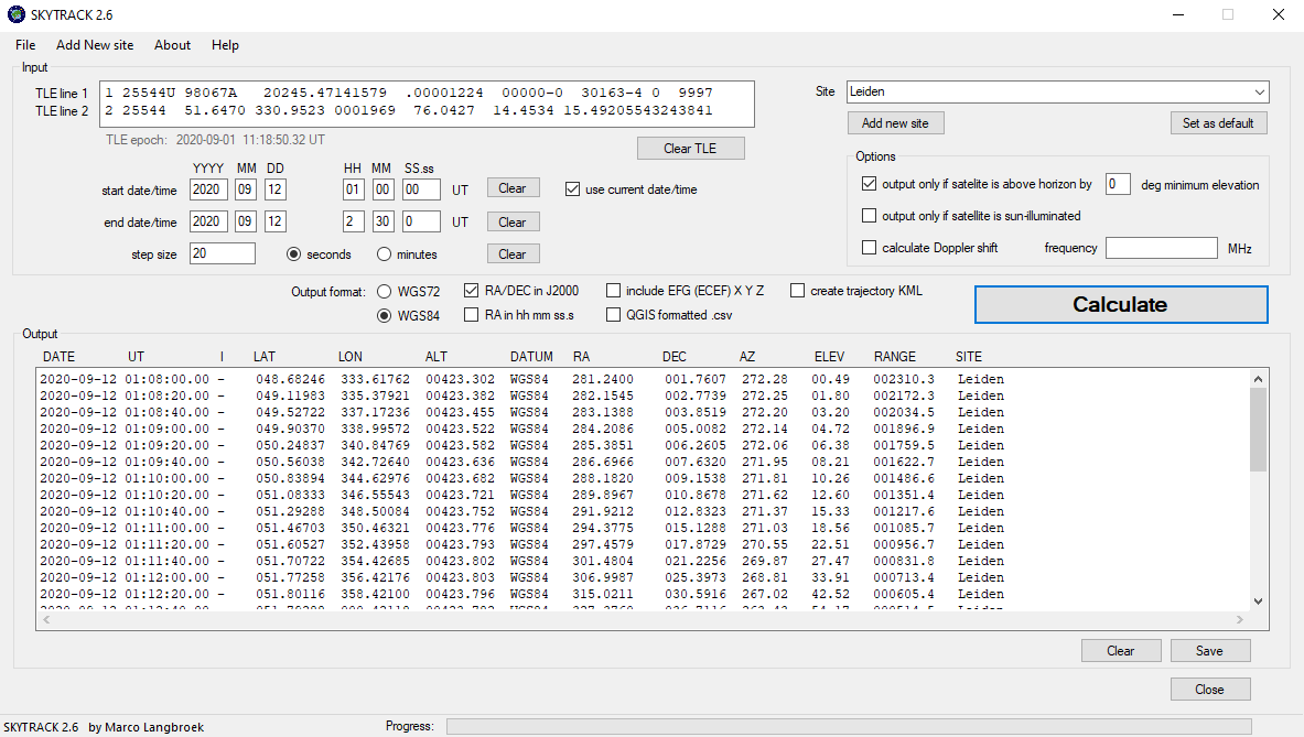
In short, the software takes as input a set of orbital elements in TLE-format, and allows you to calculate, for a given custom time interval in custom time steps:
- The latitude, longitude and altitude of the satellite;
- An indication whether it is sun-illuminated or not;
- the Right Ascension (RA) and Declination in the sky, for your observing site;
- the Azimuth and Elevation in the sky, for your observing site;
- the Range (in km) to your observing site;
...and optionally also:
- a KML file of the trajectory that you can load into Google Earth;
- the Doppler-corrected radio frequency (for a given central frequency);
- EFG (ECEF) x, y, z coordinates of the satellite;
- format the data as .csv so it can easily be imported into mapping applications like QGIS.
- choice between various output formats and Datums for the Lat/Lon and RA/DEC data
The software also has options to restrict the output to a certain minimum elevation as sen from your observing site, and/or output only when the satellite is sun-illuminated (and hence visible).
2 comments:
I found your page a couple months back searching for info on the trajectory of the crew Demo 2 launch (over Germany). I went outside with my parents as it was on my mother's birthday and she was pretty sure she actually saw dragon for a moment, so thank you for providing the info. :)
Will you have a prediction post for the upcoming crew 1 mission?
I guess I could learn how to use your software but I'm not sure if I'd get it right...
Awesome blog and work that you do
Post a Comment