Sunday, 16 April 2023

An upcoming Russian IRBM missile test on April 20-29

click map to enlarge

Two Navigational Warnings (HYDROARC 50/23 and HYDROARC 51/23) have appeared that suggest an upcoming Russian missile test of some sort in the Russian Arctic between April 20 and 29, 2023

The initial window is for 20 April, 11:00 to 15:00 UTC. Secondary windows are for 21 and 22 April 05:00 to 09:00 UTC, and 25 to 29 April 05:00 to 15:00 UTC.

The map above shows the locations of the two hazard zones. Launch is from the Barentsz Sea north of Murmansk: the target area appears to be in the East Siberian Sea near the De Long Islands, northeast of Novaya Sibir. The indicated range is about 3500 km, the orientation of the two hazard areas speaks against a lofted trajectory but rather fits a ~500 km apogee.

Initially I considered an SLBM launch, but the indicated range seems a bit short for that - I would expect an SLBM test launch to target the Kura test range in Kamchatka instead. So for now, let's keep it on an IRBM (Intermediate Range Ballistic Missile) of yet-unidentified type.

The ~3500 km range seems a bit too large for either the Zirkon hypersonic missile or Kalibr cruise missiles. So perhaps, this is something new.

The text below gives the Navigational Warnings in question:

130727Z APR 23
HYDROARC 50/23(41).
EAST SIBERIAN SEA.
RUSSIA.
DNC 27.
1. HAZARDOUS OPERATIONS, ROCKET LAUNCHING
   201100Z TO 201500Z APR, 0500Z TO 0900Z DAILY
   21 AND 22 APR AND 0500Z TO 1500Z DAILY
   25 THRU 29 APR IN AREA BOUND BY
   77-25.62N 155-33.30E, 76-48.75N 150-51.52E,
   74-12.50N 157-26.45E, 73-53.42N 161-19.82E,
   74-58.35N 161-59.62E.
2. CANCEL THIS MSG 291600Z APR 23.


142257Z APR 23
HYDROARC 51/23(42).
BARENTS SEA.
RUSSIA.
DNC 22.
1. HAZARDOUS OPERATIONS, ROCKET LAUNCHING
   201100Z TO 201500Z APR, 0500Z TO 0900Z
   DAILY 21 AND 22 APR AND 0500Z TO 1500Z DAILY
   25 THRU 29 APR IN AREA BOUND BY
   74-14.06N 039-11.16E, 73-31.48N 044-22.53E,
   69-17.38N 037-51.36E, 69-26.00N 037-03.00E,
   69-40.30N 037-03.00E, 69-40.30N 035-40.25E,
   70-10.26N 032-40.00E.
2. CANCEL THIS MSG 291600Z APR 23.

Wednesday, 12 April 2023

Optically observing the RNLAF's 6U cubesats BRIK-II, HUYGENS and BIRKELAND


WATEC 902H2 Supreme camera with Samyang 2.0/135 mm lens and GPS time inserter

The Royal Netherlands Air Force (RNLAF) launched its first satellite, the cubesat BRIK-II (2021-058F), two years ago as part of the Virgin Orbit Tubular Bells rideshare on 30 June 2021 (see an earlier post here).

Two more satellites, HUYGENS (2023-001CN) and BIRKELAND (2023-001G) were recently launched for the RNLAF as part of the SpaceX Transporter 6 rideshare on 3 January 2023. These two satellites, which move in the same orbital plane, are co-owned by the RNLAF and the Norwegian Ministry of Defense.

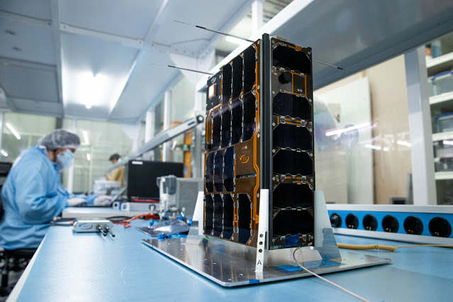
The satellites are 6U cubesats, with the bus measuring 10 x 20 x 30 cm (roughly the size of a shoebox). Huygens and Birkeland have unfolding solar panels expanding their size to about 30 x 60 cm.


Brik-II during assembly and testing (image: Netherlands Ministry of Defense)


Rendering of Huygens (image: Nanoavionics)


orbits of the Brik-II, Huyugens and Birkeland cubesats


Over the past two weeks I have imaged all three satellites from Leiden - in the case of  Huygens and Birkeland even on multiple nights - using my WATEC 902H2 Supreme camera fitted with a 2.0/135 mm light telelens. 

Brik-II remained very faint during the one pass I imaged, but Huygens and Birkeland were surprisingly easy to see, as can be seen in the framestacks and video's further down in this blogpost.


BRIK-II

Below are a framestack and a short video of the March 30 Brik-II detection. I have processed the video for visibility (which also increased the noise) as the cubesat was very faint: look for a very faint, fast object coming from the upper left corner.

I had tried to image the satellite earlier on several occasions the past two years, but this was the first time I had a positive detection.


Brik-II, framestack from footage taken March 30, 2023


video footage of Brik-II (very faint!)


HUYGENS and BIRKELAND

Below are framestacks and video footage of passes of Huygens and Birkeland taken on March 30, April 4 and April 8, 2023. These two cubesats were much more readily visible than BRIK-II and you'll have no problem seeing them in the footage

The video footage of Huygens is from April 4, of Birkeland from April 8. They were (on all three nights involved) clearly better visible than Brik-II was on March 30. This is partly due to a better observing geometry, but it does seem that Huygens and Birkeland are really intrinsically brighter than Brik-II. They reached magnitude +7.5 to +8.

First, imagery - framestacks and brief video footage - of Huygens (2023-001CN) obtained on 30 March and 4 April, 2023:


Huygens on March 30,2023 (framestack)

Huygens on April 4, 2023 (framestack)

 video footage of Huygens on April 4, 2023


Next, imagery - a framestack, and a longer video - of Birkeland (2023-001G) obtained on 8 April 2023. The bright object initially seen passing in the upper left corner is a Starlink satellite (Starlink-5226): Birkeland is the fainter object coming from bottom right:


Birkeland on April 8, 2023 (frame stack)


 video footage (longer video) of Birkeland on 8 April 2023


Equipment

All the imagery was captured with a WATEC 902H2 Supreme low-light-level cctv camera fitted with a Samyang 2.0/135 mm lens, filming at 25 frames per second. Accurate timing of the video frames was provided with a BlackBoxCamera GPSBOXSPRITE-2 GPS time-inserter.

The system delivers an astrometric accuracy of about 15 arcseconds. The FOV is about 2.7 x 2.0 degrees. The footage was shot from my home in the center of Leiden, the Netherlands (52.154 N, 4.491 E).

The image below shows the equipment in question. The box at left is the GPS time inserter. The PAL video feed from the WATEC camera goes from the camera into the time inserter, which imprints each individual videoframe with a millisecond-accuracy time derived from GPS signals. After passing through the time inserter the video feed is going to a digitization dongle, and is next recorded on a laptop.


WATEC 902H2 Supreme camera with Samyang 2.0/135 mm lens and GPS time inserter


I used my observations to provide these orbit updates for Huygens and Birkeland:


HUYGENS
1 55093U 23001C   23098.81960162 0.00006982  00000-0  37378-3 0    02
2 55093  97.4857 159.4790 0014652 237.3630 122.6188 15.14989127    06

rms 0.004 deg   arc 30.85 Mar - 8.83 Apr UTC


BIRKELAND
1 55015U 23001G   23098.83187223 0.00009789  00000-0  53865-3 0    04
2 55015  97.4960 159.3843 0009401 256.5788 103.4395 15.14067850    03

rms 0.003 deg   arc 4.88 - 8.84 Apr UTC


These observations have wet my appetite to try to image more cubesats. The observations also underline (as we recently did in a conference publication as well) the power of relatively small but sensitive equipment. You really don't need a big telescope to track cubesats.


More on these satellites

With Brik-II, Huygens and Birkeland, the RNLAF is now entering active operations in the Space Domain.


Huygens and Birkeland are named after two iconic scientists, the Dutch Christiaan Huygens (1629-1695) and the Norwegian Kristian Birkeland (1867-1917). They were developed as part of the joint Milspace-2 program of the Dutch and Norwegian Ministries of Defense.

The two satellites operate as a pair, in the same 97.5 degree inclined orbital plane, Huygens currently in a 531 x 511 km orbit, Birkeland currently in a 530 x 517 km orbit. 

Their primary mission is ELINT: the geolocation and fingerprinting of Radar emissions. The two satellites are also used for experiments with formation flying.


Huygens and Birkeland orbit


Brik-II is named after Brik, the very first aircraft of a forerunner of the RNLAF, the "Luchtvaartafdeling" of the Royal Dutch Army, back in 1913. 

In Dutch, the word "brik" has several meanings: it is Dutch for "brick", as well as a slang name for a means of transportation (a cart or a car), in the latter case usually with the added connotation of it being somewhat decrepit.

The satellite is in a 60.7 degree inclined, 515 x 466 km orbit. Its experimental mission includes ELINT, communications, and Spaceweather monitoring. It was built for the Dutch Ministry of Defense by ISISpace in Delft. It is operated by the Defense Space Security Center in Breda.


"Brik", the first aircraft of the Dutch military, in 1913 (image Dutch Ministry of Defense)


Brik-II orbit 


Sunday, 9 April 2023

An upcoming French SLBM test in the Atlantic [UPDATED]

click map to enlarge

Spring has arrived, and this spring the fledgeling missiles fly, as I already noted in a previous post

And now the French join in this springtime Missile Mêlée too: two Navigational Warnings have appeared (HYDROLANT 759/23 and NAVAREA IV 396/23) that indicate a French Submarine-Launched Ballistic Missile (SLBM) test for the period 14 April - 7 May, 2023.

I have mapped the hazard areas from the two Navigational Warnings (text below) in the map above.


070934Z APR 23
HYDROLANT 759/23(36,37,38).
BAY OF BISCAY.
CELTIC SEA.
NORTH ATLANTIC.
FRANCE.
DNC 08, DNC 19.
1. HAZARDOUS OPERATIONS, ROCKET LAUNCHING
   0030Z TO 1000Z DAILY 14 APR THRU 07 MAY
   IN AREAS BOUND BY:
   A. 47-39.00N 004-01.00W, 47-48.71N 004-31.00W,
      47-44.70N 005-23.50W, 47-16.46N 005-17.68W,
      47-24.00N 004-11.00W.
   B. 47-44.70N 005-23.50W, 47-35.30N 007-15.13W,
      47-04.30N 007-08.53W, 47-16.46N 005-17.68W.
   C. 47-35.30N 007-15.13W, 47-29.72N 008-09.53W,
      46-58.78N 008-02.44W, 47-04.30N 007-08.53W.
   D. 48-04.60N 008-59.32W, 47-46.75N 011-31.33W,
      46-00.58N 011-02.17W, 46-17.87N 008-34.97W.
   E. 45-25.54N 025-00.90W, 44-55.65N 027-03.41W,
      43-42.92N 026-27.47W, 44-12.20N 024-27.20W.
2. CANCEL THIS MSG 071100Z MAY 23.


070934Z APR 23
NAVAREA IV 396/23(14,51).
NORTH ATLANTIC.
1. HAZARDOUS OPERATIONS, ROCKET LAUNCHING
   0030Z TO 1000Z DAILY 14 APR THRU 07 MAY
   IN AREA WITHIN 150 MILES OF 37-35.15N 045-40.37W.
2. CANCEL THIS MSG 071100Z MAY 23.


The missile is likely an M51, and will be launched from a French submarine south of the Breton coast. The target area is in the mid-Atlantic, near 37.6 N, 45.7 W. The indicated range is about 3500 km

A previous test three years ago, on 12 June 2020, had over 1.5 times that range. So this test either has a more significant payload (e.g. multiple MIRV's or heavier warhead(s)), or uses reduced power in the first stage, or (less likely, also looking at the locations of the hazard areas) is a highly lofted test for some reason.

The target area in the mid-Atlantic is about 1.6 times bigger than it was with the 2020 test (300 Nautical mile wide now, versus 184 Nautical mile wide in 2020) even though the range is ~1.6 times shorter, which might perhaps indicate multiple warheads (MIRV).

The map below compares the 12 June 2020 test (red) to the upcoming test (blue):

click map to enlarge

UPDATE 19 April 2023:

Tweets by the French Navy and the French Minister of Defense on April 19 confirm a successful test firing of an M51 SLBM from the submarine Le Terrible on 19 April 2023.

Saturday, 1 April 2023

The STARSHIP inaugural launch is near! [UPDATED]

Launch trajectory. Click image to enlarge

UPDATE 7 April 2023: New Navigational Warnings have been published which indicate that the launch date is being pushed back to the second half of April. The new Navigational Warnings are for April 17-21.

UPDATE 15 April 2023:  The 2.5 hour launch window opens 17 April 12:00 UTC

***

(this blogpost has been updated several times)

Navigational Warnings (NAVAREA IV 372/23 and NAVAREA XII 176/23) were published today for the long awaited inaugural launch of SpaceX's STARSHIP, the vehicle that one day should bring people to the Moon and Mars.

The Navigational Warnings fit an orbit with an orbital inclination of about 26.36 degrees. The resulting trajectory is visualised in the map above (numbers next to the trajectory represent the approximate elapsed time, in minutes, after launch). 

Launch is from Starbase Texas, and just short of one full revolution after launch (i.e., strictly speaking this is a suborbital flight), Starship will splash down in the Pacific Ocean in the Pacific Missile Range north of Hawaii.

The estimated TLE below is for launch on April 6 at 11:25 UTC:

STARSHIP                      for launch on 6 April 2023 11:25:00 UTC
1 70002U 23999A   23096.47569444  .00000000  00000-0  00000-0 0    07
2 70002 026.3626 168.8581 0338186 110.5558 323.6714 15.99790612    02

The estimated TLE below is for launch on April 17 at 12:00 UTC:

STARSHIP                     for launch on 17 April 2023 12:00:00 UTC
1 70000U 23999A   23107.50000000  .00000000  00000-0  00000-0 0    00
2 70000 026.3800 188.2482 0141857 110.7597 322.5585 16.48799354    03

If the launch actually is on another date/time, you can adjust the TLE to the new date/time with my program "TLEfromProxy".

If launch is near 12:00 UTC on April 17, there are no visible passes (except for a very desolate part of the Indian Ocean). However: the reentry fireball is likely visible from Hawaii.

The window of the Navigational Warnings runs from April 6 to April 12, 11:25 to 17:10 UTC daily. April 17 to April 21, 11:25 to 17:10 UTC daily. The text of the original Navigational Warnings is below (the Warnings for April 17 are identical in geographic locations):


250611Z MAR 23
NAVAREA IV 372/23(11,28).
GULF OF MEXICO.
TEXAS.
1. HAZARDOUS OPERATIONS, ROCKET LAUNCHING
   1125Z TO 1710Z DAILY 06 THRU 12 APR
   IN AREAS BOUND BY
   25-57.00N 097-12.00W, 26-02.00N 097-12.00W,
   26-06.00N 096-46.00W, 26-05.00N 095-44.00W,
   25-57.00N 093-13.00W, 25-43.00N 092-44.00W,
   25-33.00N 092-44.00W, 25-32.00N 093-07.00W,
   25-47.00N 095-14.00W, 25-52.00N 096-17.00W,
   25-53.00N 096-46.00W.
2. HAZARDOUS OPERATIONS, SPACE DEBRIS
   1255Z TO 1710Z DAILY 06 THRU 12 APR
   IN AREAS BOUND BY
   25-57.00N 097-12.00W, 26-02.00N 097-12.00W,
   26-03.00N 097-07.00W, 26-07.00N 096-59.00W,
   26-10.00N 096-49.00W, 26-32.00N 096-25.00W,
   26-42.00N 095-34.00W, 26-42.00N 092-53.00W,
   26-08.00N 091-05.00W, 25-32.00N 090-24.00W,
   24-37.00N 084-52.00W, 24-30.00N 084-52.00W,
   25-09.00N 090-30.00W, 24-55.00N 091-06.00W,
   25-09.00N 092-53.00W, 25-14.00N 093-53.00W,
   24-58.00N 094-40.00W, 25-12.00N 096-10.00W,
   25-54.00N 097-04.00W
2.CANCEL THIS MSG 121810Z APR 23.//


291338Z MAR 23
NAVAREA XII 176/23(GEN).
NORTH PACIFIC.
HAWAII TO MARSHALL ISLANDS.
1. HAZARDOUS OPERATIONS, ROCKET LAUNCHING
   1125Z TO 1850Z DAILY 06 THRU 12 APR
   IN AREA BOUND BY
   23-49.00N 157-42.00W, 23-30.00N 157-37.00W,
   23-40.00N 156-57.00W, 23-58.00N 157-03.00W.
2. HAZARDOUS OPERATIONS, SPACE DEBRIS
   1255Z TO 1850Z DAILY 06 THRU 12 APR
   IN AREA BOUND BY
   22-09.00N 167-02.00W, 19-50.00N 174-26.00W,
   18-19.00N 179-59.90W, 15-00.00N 173-24.00E,
   11-44.00N 167-39.00E, 11-18.00N 167-54.00E,
   13-44.00N 174-11.00E, 16-08.00N 179-30.00W,
   18-10.00N 173-45.00W, 20-13.00N 167-33.00W,
   21-52.00N 162-27.00W, 22-26.00N 160-32.00W,
   23-04.00N 157-57.00W, 23-36.00N 155-42.00W,
   24-05.00N 154-01.00W, 24-24.00N 153-16.00W,
   24-43.00N 152-44.00W, 24-49.00N 152-48.00W,
   24-41.00N 154-58.00W, 24-08.00N 158-18.00W,
   23-21.00N 162-33.00W.
3. CANCEL THIS MSG 121950Z APR 23.//

Inaugural launches tend to slip, so it is well possible that the launch evetually will postpone to after April 12. But you never know! 

EDIT: and this happened. launch currently slaterd for April 17, see edarloier in this several times updated blogpost.