Tuesday, 28 September 2021

Spectacular deorbit burn / fuel dump from the Landsat 9 Centaur upper stage observed

click to enlarge
 

Yesterday 27 September 2021 at 18:12 UT, Landsat 9 was launched from Vandenberg with a ULA Atlas V rocket. 

2h 58m after the launch, after 1.5 revolutions and while over the east coast of the United Kingdom, the Centaur upper stage performed its deorbit burn, lowering perigee such that half an orbit later it would reenter over a designated area in the Pacific Ocean at the end of the second revolution. Following the deorbit burn, there was a fuel blow-out.

click map to enlarge

The deorbit burn and fuel blowout happened within minutes of shadow exit over NW Europe. When the resulting exhaust and fuel clouds came into sunlight, they caused a bright spectacle in the sky that was widely seen around 21:12 UT (23:12 CEST) from a.o. the Netherlands, the UK, Belgium, France and Scandinavia.

The event was anticipated: already before the launch, Cees Bassa had noted that the time of the burn coincided with a pass over NW Europe and alerted observers on the Satobs list. I then put out additional alerts on a.o. Twitter, and as a result, many people observed it. 

In addition, there were hundreds of unexpecting casual eyewitnesses, who often had no clue as to what they were seeing. One of the Dutch "UFO"-reporting sites got over 150 reports of a "UFO" in the northern sky as a result.

As seen from my hometown Leiden in the Netherlands, shadow exit would occur low in the northern sky, in Ursa Major. I had put up my camera opposite the historic Leiden Observatory in the center of Leiden, hoping to capture it over the telescope domes.

As it happened, the actual sky trajectory was slightly more eastwards in the sky than we had anticipated based on a pre-launch TLE estimate (my estimate placed in in the tail of the Big Dipper, while in reality it was in the bowl of the Big Dipper). Just enough to place it outside the FOV of my camera (and initially behind a tree). 

So when it became visible and I realized it was off the predictions, I quickly grabbed the tripod and repositioned it. This made me photographically miss the first 20 seconds or so of the event. Over slightly more than 1 minute, I managed to shoot 50 images of the exhaust and fuel clouds descending over the roof of one of the Observatory's auxilliary buildings.

I was lucky with the clouds too. Fields of cumulus were drifting across the sky, and the relevant part of the sky had been clouded out only minutes before the observation (the clouds leaving the scene are visible in the photographs and time-lapse below).

The event was downright spectacular: two v-shaped, comet-like clouds, one very bright and one fainter (see images) with the tips upward, moving down in the sky among the stars of Ursa Major. The brighter, trailing one of the two clouds was easily visible, and of negative magnitude (mag -4 perhaps, as a rough estimate). It's shape changed over time, with a shell-like structure moving away from the tip. Very spectacular!

The fainter cloud is probably rocket engine exhaust from the brief deorbit burn. The brighter cloud is a cloud of fuel particles, resulting from the blow-out (depressurization) of the Centaur's fuel tanks after the burn (this is a.o. done to avoid fuel remnants exploding). Both clouds are illuminated by the sun, which is why they are visible.

Here are some of the 50 images I shot


click images to enlarge

In two consecutive of the 50 images, an object briefly becomes visible between the fuel and exhaust clouds (arrow): it is not clear what this exactly is, as one would not expect the Centaur itself in this position (rather, at the tip of the bright cloud).

click to enlarge


Below is a time-lapse movie I constructed from the 50 images. It is at 13 times the real speed: the series of images from which the movie was made spans slightly over 1 minute in time:


The event happened somewhere between ~550 and 685 km altitude, over the United Kingdom and North Sea. An exact altitude cannot be given at the moment: landsat 9 was delivered to a ~685 km orbit, but the rocket made additional manoeuvres, while releasing cubesats.

I have always wanted to see an event like this, and now finally have (my 51 degree North NW European location does not see this kind of events often). Still on my list: a real reentry.

(all the images shown here were made with a Canon EOS 80D camera and EF 2.0/35 mm lens, at 1-second exposure at ISO 2500).

Friday, 17 September 2021

Inspiration4 Crew Dragon over the old Leiden Observatory

click to enlarge
 

The image above, which I shot yesterday evening (16 September 2021) around 19:24 UT, shows the SpaceX Crew Dragon Inspiration 4 with astronauts Hayley Arceneaux, Christopher Sembroski, Sian Proctor and Jared Isaacman onboard, over one of the domes of the old Leiden Observatory. This observatory is located in the center of Leiden, the Netherlands, close to my home.

The photograph is a stack of 37 1-second images taken between 19:24:05 and 19:25:19 UT with a Canon EOS 80D and EF 2.5/50 mm lens (at 800 ISO). The dome is the dome of the 50-cm Zundermann telescope. The brightest "star" is Jupiter, and the second trail near the bottom of the image next to the dome is an aircraft.

Inspiration 4 is the first Crew Dragon mission that was not commissioned by NASA and does not go to the International Space Station. Instead it will orbit for 3 days at an altitude of 570 x 580 km. The orbital plane is inclined by 51.6 degrees and does match the ISS orbital plane, although not the ISS orbital altitude. It was chosen so that the launch could use existing emergency and abort facilities on the launch track. 

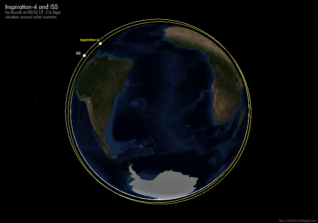
Inspiration4 (2021-084A) was launched from pad 39A at Cape Canaveral on 16 September 2021 at 00:02:56 UT. The launch coincided, with a difference of only a few minutes, with a pass of the ISS:


While I was photographing the pass (which was a low elevation pass in late twilight at 25 degrees maximum elevation) from a spot at the Witte Singel opposite the observatory, my video setup was running on an automated schedule from my loft window and captured the spacecraft as well (WATEC 902H2 Supreme camera with 1.4/35 mm lens at 25 fps):


An upcoming Trident-II D5 SLBM test in the Atlantic

click map to enlarge

A few days ago a Navigational Warning (NAVAREA IV 838/21, also issued as HYDROLANT 2336/21) appeared which points to an upcoming Trident-II D5 SLBM (Submarine-Launched Ballistic Missile) test from a US or Royal Navy SSBN on the Atlantic Eastern Missile Range between 12:30 UT on September 17, and 1:23 UT on Sept 20. The distance between the launch area and MIRV target area is about 9900 km.

This is the text of the Navigational Warning (the map in top of this post shows them mapped, along with a simple ballistic trajectory):

151459Z SEP 21
NAVAREA IV 838/21(11,24,26).
ATLANTIC OCEAN.
FLORIDA.
1. HAZARDOUS OPERATIONS 171230Z THRU 200123Z SEP
   IN AREAS BOUND BY:
   A. 28-56N 079-59W, 29-02N 079-53W,
      29-06N 079-37W, 28-59N 079-10W,
      28-37N 079-10W, 28-36N 079-35W,
      28-45N 079-56W.             
   B. 28-24N 076-44W, 28-42N 076-42W,
      28-21N 074-40W, 28-06N 074-44W.
   C. 27-27N 071-21W, 27-52N 071-15W,
      27-25N 068-46W, 26-54N 068-54W.
   D. 17-22N 044-54W, 18-33N 044-32W,
      16-54N 040-55W, 16-00N 041-23W.
   E. 09-00S 003-51W, 08-22S 003-22W,
      12-35S 002-40E, 13-05S 002-19E,
      11-56S 000-16E, 12-09S 000-16W,
      11-34S 000-20W.
2. CANCEL THIS MSG 200223Z SEP 21.

The launch area (area A) is one of two launch areas used for these kind of tests in the Atlantic (see an earlier post from 2019 analyzing several of these launches). It is the variant closest to the Florida coast, one which I suspect is used when the launch has an 'audience' of officials.

The area is close enough to the Florida coast that Florida east coast residents might see the launch, as has previously happened.

The target area is the regular target area in the southern Atlantic some 1000 km out of the coast of Angola.

Areas B, C and D are where the first, second and third stage splash down.


The location of the hazard areas does not match a simple ballistic trajectory well (such a trajectory is indicated by the line in the map in the top of this post), which might point to some mid-flight manoeuvering of the MIRV-bus.

The test launch is probably a DASO ("Demonstration and Shakedown Operation"), done to recertify the readiness of the submarine and its crew after major overhauls. One candidate submarine for this test launch is the Ohio-class SSBN USS Tennessee (SSBN 734) which reportedly completed a major overhaul at Kings Bay on July 1. [EDIT 18 sept 2021 15:45 UT: it actually was USS Wyoming, which fired two Trident missiles as part of the test]


UPDATE 18 Sep 2021 15:45 UT

The US Navy has announced that as part of DASO-31, the Ohio-class SSBN-742 USS Wyoming has fired two Trident missiles on September 17th.

image: US Navy/David Holmes
image US Navy/David Holmes


Tuesday, 14 September 2021

PAN (NEMESIS 1) is on the move again

Pan on August 8/9, 2021, imaged from Leiden. Click image to enlarge

Five years ago, in 2016, I wrote a long article in The Space Review titled "A NEMESIS in the sky: PAN, Mentor 4 and close encounters of the SIGINT kind". The primary subjects of that article were two SIGINT satellites: PAN (Nemesis 1) and Mentor 4.

In the article, I discussed what we had observed and deduced about PAN as amateur trackers, to what had been recently revealed about PAN by leaked documents from the Snowden files.

In the article I documented the frequent movements of PAN (2009-047A): for four years between its launch in September 2009 and mid 2013, PAN, very unusual for a geosynchronous satellite, was roving from location to location, each time being put close to a satellite for commercial satellite telephony.
For information on the "why" of that, and the larger context of it (a new kind of SIGINT information gathering), I refer to the earlier mentioned Space Review paper which goes into details.

Mid-2013, four years after launch, the frequent relocations stopped. For 8 years, the position of PAN remained stable in longitude near 47o.7 E. It's roving days, snooping around and sniffing other satellites, were over. Until this year.  

Somewhere between 6 February and 7 May 2021, PAN started to move again, eastwards in longitude. Observed longitudes over the period May-August 2021 suggest a drift eastwards at about 0.025 deg/day

Assuming a stable drift, the move appears to have been initiated within a few days of 11 February, 2021.The last observation still showing PAN at 47.7 E was on 6 February 2021 (as it happens, our network did not observe it again untill early May 2021 when it had already moved eastwards by two degrees).

The diagram below (an updated version of one that appeared in my 2016 Space Review article) shows the positions in longitude that PAN has been taking up since its launch in 2006. Note the frequent relocations over the period 2009-2013, then the long stabilization at 47.7E, and the start of a new drift episode in 2021:

click diagram to enlarge


The question now is, what this drift since February means:

(1) Has it deliberately been brought into a drift state to move it to an eventual new position? 

(2) Has it reached end-of-life and been manoeuvered into a graveyard orbit?

A 'graveyard orbit' is usually an orbit that is located at least 235 km higher than a geosynchronous orbit. That does not appear to be the case here: if anything, the orbit seems to be a few km lower than it previously was. So it appears to be option (1).

It will be interesting to see whether PAN will stabilize its longitude at some point or not, and where that will be. Unfortunately, as it is drifting eastwards it is getting lower in my sky (currently, it is some 16 degrees above my local horizon), and there do not appear to be many other amateurs covering it currently.

It would be interesting to see whether radio observers can detect radio signals from PAN, which shortly after launch was emitting at frequencies similar to that of the "UFO" (UHF Follow On) constellation.


PAN on 2/3 June, 2021, imaged from Schiermonnikoog Island. Click to enlarge

Sunday, 12 September 2021

An Asteroid for Alice


As long-time readers of this blog know, I have been active in searching for Near Earth Asteroids (discovering two: 2005 GG81 and 2015 CA40). As part of that search, I also discovered a number of new Main Belt asteroids

A batch of these, that where discovered by Krisztian Sárneczky and me with the 60-cm Schmidt of MPC 461 Piszkéstető in Hungary in the period 2012-2016, are now well observed enough that they are getting permanent numbers issued by the MPC. Which means that we have the opportunity to suggest names for these asteroids to the IAU.

The first name we proposed was accepted and published by the Work Group on Small Body Nomenclature (WGSBN) of the International Astronomical Union (IAU) last week. 

It is with much pleasure that I can announce that asteroid (551014) = 2012 UU185 will henceforth be called:


(551014) Gorman


...after Dr Alice Gorman, a pioneer "Space Archaeologist" and senior Lecturer at Flinders University in Australia.


Dr Alice Gorman
 

Dr Alice Gorman is a pioneer in the field of Space Archaeology: the study of human material culture in space, and Space-Age related human material culture on earth (e.g. old launch or tracking sites). Some of you may know here from her book "Dr Space Junk vs the Universe" (if you don't know the book, I can warmly recommend it).

 The naming citation for the asteroid was published on 3 September 2021 in WSGBN-bulletin vol 1. nr 7 and reads:

(551014) Gorman = 2012 UU185 

Discovery: 2012-10-18 / K. Sárneczky, M. Langbroek * / Piszkéstető / 461 

Alice Gorman (b. 1964) is an Australian archaeologist and an expert in lithic analysis and Heritage management. She is one of the pioneers in the field of space archaeology, the study of human material culture in space and related material culture on Earth.


Asteroid (551014) Gorman was discovered on 18 October 2012 as a magnitude +19.2 object by Krisztian Sárneczky and me with the 60-cm Schmidt of MPC 461 Piszkéstető Observatory in the Matra mountains of Hungary. The animated GIF in the top of this post shows a 'blink' of a small part of the three discovery images (taken about 15 minutes apart). The asteroid can be seen as a faint moving dot in the center.

Our initial internal reference for the objects given on the night of discovery was object SaLa016. After submission to the MPC, it got the temporary designation 2012 UU185. In June this year, it was issued the permanent number (551014).

(551014) Gorman is an approximately 2 km wide asteroid (H = 15.9) that moves in the asteroid belt between Mars and Jupiter. It is a Main Belt IIIb type asteroid with perigee at 2.97 AU and an orbital inclination of 14 degrees. It takes the asteroid 5.8 years to complete one orbit around the sun.


It makes me very happy to have been able to name this asteroid after Alice!